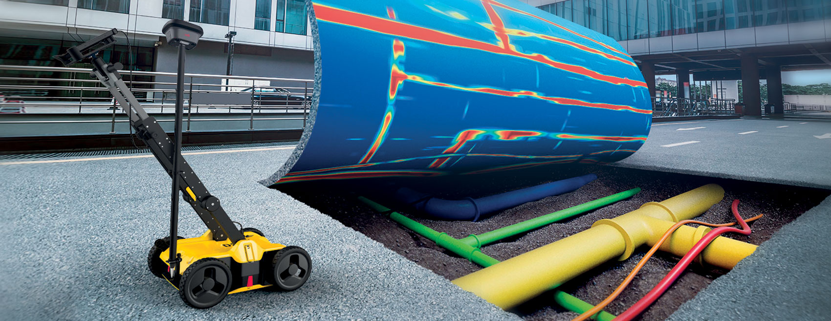
Ground Penetrating Radar (GPR) is a high-tech tool that enables fast, accurate, and real-time detection and mapping of the work area, identifying underground pipes, cables, metallic and non-metallic objects, and other buried obstacles. This helps prevent damage to public utilities by locating them before excavation begins.
The system allows data collection reports to be exported—including maps and targets captured directly in the field—with georeferencing, and the identified elements can be transferred to CAD/GIS platforms for professional utility mapping. This enables the creation of a precise 3D reconstruction of the underground network and the integration of this information with any existing cartography.